
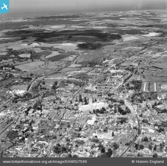
EAW017599 ENGLAND (1948). Christ Church Cathedral and the surrounding city, Canterbury, from the south, 1948. This image has been produced from a print.
© Copyright OpenStreetMap contributors and licensed by the OpenStreetMap Foundation. 2026. Cartography is licensed as CC BY-SA.
Nearby Images (27)
EAW017599

EAW017598

EAW014335

EAW011396

EPW018612

EAW017600

EAW004808

EPW038149

EAW014334

EPW000393

EPW009143

EAW004807

EPW009147

EPW009140

EPW009146

EPW013272

EAW011399

EAW047757

EAW004809

EAW047755

EPW009141

EAW004806

EPW013271

EPW009144

EAW028821

EPW009139

EAW047756

Details
| Title | [EAW017599] Christ Church Cathedral and the surrounding city, Canterbury, from the south, 1948. This image has been produced from a print. |
| Reference | EAW017599 |
| Date | 22-July-1948 |
| Link | |
| Place name | CANTERBURY |
| Parish | |
| District | |
| Country | ENGLAND |
| Easting / Northing | 615047, 157715 |
| Longitude / Latitude | 1.0837152176239, 51.277418584762 |
| National Grid Reference | TR150577 |
Pins

Alan McFaden |
Thursday 28th of August 2014 09:49:08 AM |
