
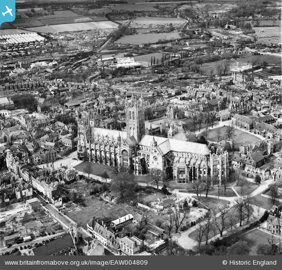
EAW004809 ENGLAND (1947). Christchurch Cathedral and the cathedral close, Canterbury, 1947
© Copyright OpenStreetMap contributors and licensed by the OpenStreetMap Foundation. 2026. Cartography is licensed as CC BY-SA.
Nearby Images (26)
EAW004809

EAW011399

EAW047755

EPW038149

EAW004808

EPW009140

EPW009139

EAW004807

EPW009147

EAW047756

EPW013271

EAW047757

EPW009144

EPW013272

EPW009146

EPW009141

EPW000393

EAW004806

EAW028821

EPW009143

EAW017600

EAW028822

EAW017599

EAW014335

EAW017598

EAW014334

Details
| Title | [EAW004809] Christchurch Cathedral and the cathedral close, Canterbury, 1947 |
| Reference | EAW004809 |
| Date | 25-April-1947 |
| Link | |
| Place name | CANTERBURY |
| Parish | |
| District | |
| Country | ENGLAND |
| Easting / Northing | 615101, 157921 |
| Longitude / Latitude | 1.0846123625188, 51.27924804098 |
| National Grid Reference | TR151579 |
Pins

Alan McFaden |
Thursday 10th of July 2014 01:48:10 PM | |
|
Alan McFaden |
Thursday 10th of July 2014 01:44:01 PM | |
|
Alan McFaden |
Thursday 10th of July 2014 01:43:10 PM | |
|
Alan McFaden |
Thursday 10th of July 2014 01:42:17 PM | |
|
Alan McFaden |
Thursday 10th of July 2014 01:41:36 PM |


