
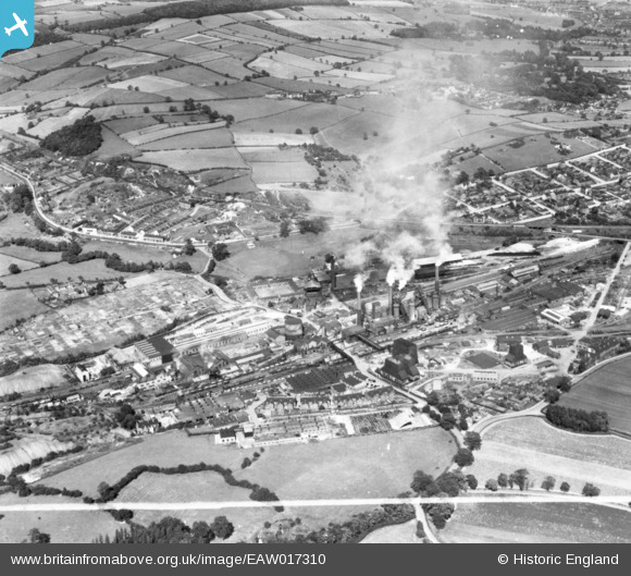
EAW017310 ENGLAND (1948). The Sheepbridge Iron Works and environs, Sheepbridge, 1948. This image has been produced from a print marked by Aerofilms Ltd for photo editing.
© Copyright OpenStreetMap contributors and licensed by the OpenStreetMap Foundation. 2026. Cartography is licensed as CC BY-SA.
Nearby Images (26)
EAW017310

EPW048959

EAW017312

EAW017311

EPW048954

EPW048953

EPW048958

EAW034552

EAW034554

EAW017308

EAW034560

EAW034567

EAW034553

EPW048955

EPW048956

EAW034551

EPW048952

EPW048951

EAW034563

EPW048957

EPW048961

EAW034562

EAW034558

EAW034566

EPW048960

EAW034564

Details
| Title | [EAW017310] The Sheepbridge Iron Works and environs, Sheepbridge, 1948. This image has been produced from a print marked by Aerofilms Ltd for photo editing. |
| Reference | EAW017310 |
| Date | 19-July-1948 |
| Link | |
| Place name | SHEEPBRIDGE |
| Parish | |
| District | |
| Country | ENGLAND |
| Easting / Northing | 437394, 374899 |
| Longitude / Latitude | -1.4392445282983, 53.269484651839 |
| National Grid Reference | SK374749 |
Pins
Be the first to add a comment to this image!