
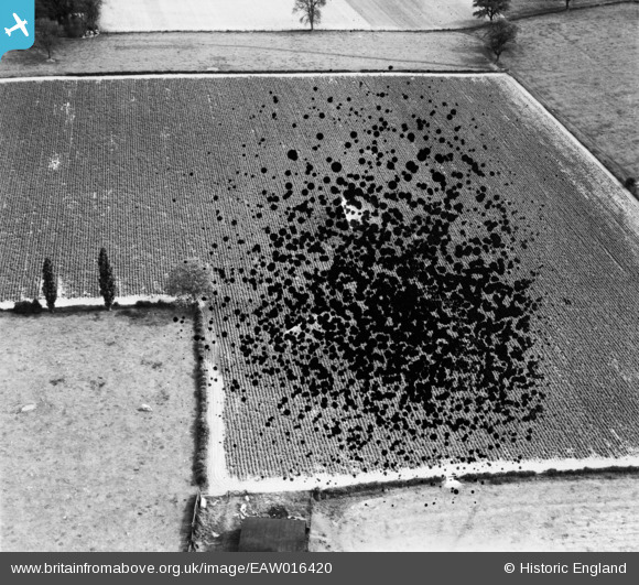
EAW016420 ENGLAND (1948). A crop being watered with impact sprinklers, Sambrook, 1948. This image has been produced from a damaged negative.
© Copyright OpenStreetMap contributors and licensed by the OpenStreetMap Foundation. 2026. Cartography is licensed as CC BY-SA.
Nearby Images (2)
EAW016420

EAW016419

Details
| Title | [EAW016420] A crop being watered with impact sprinklers, Sambrook, 1948. This image has been produced from a damaged negative. |
| Reference | EAW016420 |
| Date | 9-June-1948 |
| Link | |
| Place name | SAMBROOK |
| Parish | CHETWYND |
| District | |
| Country | ENGLAND |
| Easting / Northing | 371580, 324332 |
| Longitude / Latitude | -2.4217272355576, 52.81544891667 |
| National Grid Reference | SJ716243 |
Pins
Be the first to add a comment to this image!
User Comment Contributions
EAW016422 is of Big Mere, Marbury on 9th June 1948. This photo could be close. |

Class31 |
Tuesday 4th of February 2014 01:04:27 PM |