
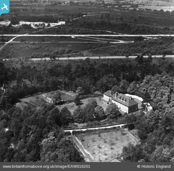
EAW016201 ENGLAND (1948). Danewell House off Woodham Lane, Woking, 1948. This image has been produced from a print marked by Aerofilms Ltd for photo editing.
© Copyright OpenStreetMap contributors and licensed by the OpenStreetMap Foundation. 2026. Cartography is licensed as CC BY-SA.
Nearby Images (6)
EAW016201

EAW016199

EAW016198

EAW016200

EAW016196

EAW016197

Details
| Title | [EAW016201] Danewell House off Woodham Lane, Woking, 1948. This image has been produced from a print marked by Aerofilms Ltd for photo editing. |
| Reference | EAW016201 |
| Date | 8-June-1948 |
| Link | |
| Place name | WOKING |
| Parish | |
| District | |
| Country | ENGLAND |
| Easting / Northing | 501610, 160663 |
| Longitude / Latitude | -0.54121933878057, 51.33546525056 |
| National Grid Reference | TQ016607 |
Pins
Be the first to add a comment to this image!