
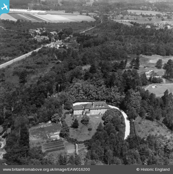
EAW016200 ENGLAND (1948). Danewell House off Woodham Lane, Woking, 1948. This image has been produced from a print.
© Copyright OpenStreetMap contributors and licensed by the OpenStreetMap Foundation. 2026. Cartography is licensed as CC BY-SA.
Nearby Images (6)
EAW016200

EAW016198

EAW016199

EAW016201

EAW016197

EAW016196

Details
| Title | [EAW016200] Danewell House off Woodham Lane, Woking, 1948. This image has been produced from a print. |
| Reference | EAW016200 |
| Date | 8-June-1948 |
| Link | |
| Place name | WOKING |
| Parish | |
| District | |
| Country | ENGLAND |
| Easting / Northing | 501634, 160725 |
| Longitude / Latitude | -0.54085720119444, 51.336018330006 |
| National Grid Reference | TQ016607 |
