
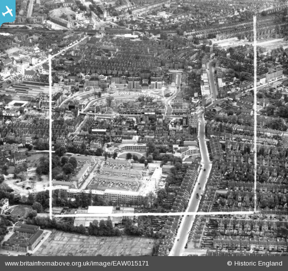
EAW015171 ENGLAND (1948). Abbeville Road, Clapham Crescent and environs, Clapham Common, 1948. This image has been produced from a print marked by Aerofilms Ltd for photo editing.
© Copyright OpenStreetMap contributors and licensed by the OpenStreetMap Foundation. 2024. Cartography is licensed as CC BY-SA.
Nearby Images (3)
EAW015171

EAW015169

EAW015170

Details
| Title | [EAW015171] Abbeville Road, Clapham Crescent and environs, Clapham Common, 1948. This image has been produced from a print marked by Aerofilms Ltd for photo editing. |
| Reference | EAW015171 |
| Date | 5-May-1948 |
| Link | |
| Place name | CLAPHAM COMMON |
| Parish | |
| District | |
| Country | ENGLAND |
| Easting / Northing | 529674, 175019 |
| Longitude / Latitude | -0.13327174827836, 51.458786939379 |
| National Grid Reference | TQ297750 |
Pins
 Astra |
Sunday 14th of May 2023 12:16:46 PM | |
steve92b |
Tuesday 23rd of June 2020 09:03:39 AM | |
brianbeckett |
Saturday 23rd of May 2020 06:20:38 PM | |
brianbeckett |
Saturday 23rd of May 2020 06:19:46 PM | |
Nowy Paul |
Saturday 22nd of June 2019 02:09:09 PM | |
brianbeckett |
Tuesday 23rd of September 2014 04:00:56 PM | |
brianbeckett |
Tuesday 23rd of September 2014 04:00:19 PM |


