
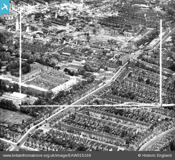
EAW015169 ENGLAND (1948). Abbeville Road, Clapham Crescent and environs, Clapham Common, 1948. This image has been produced from a print marked by Aerofilms Ltd for photo editing.
© Copyright OpenStreetMap contributors and licensed by the OpenStreetMap Foundation. 2025. Cartography is licensed as CC BY-SA.
Nearby Images (3)
EAW015169

EAW015171

EAW015170

Details
| Title | [EAW015169] Abbeville Road, Clapham Crescent and environs, Clapham Common, 1948. This image has been produced from a print marked by Aerofilms Ltd for photo editing. |
| Reference | EAW015169 |
| Date | 5-May-1948 |
| Link | |
| Place name | CLAPHAM COMMON |
| Parish | |
| District | |
| Country | ENGLAND |
| Easting / Northing | 529627, 174898 |
| Longitude / Latitude | -0.13399231435679, 51.45771018252 |
| National Grid Reference | TQ296749 |
Pins

brianbeckett |
Wednesday 8th of October 2014 02:01:55 PM |