
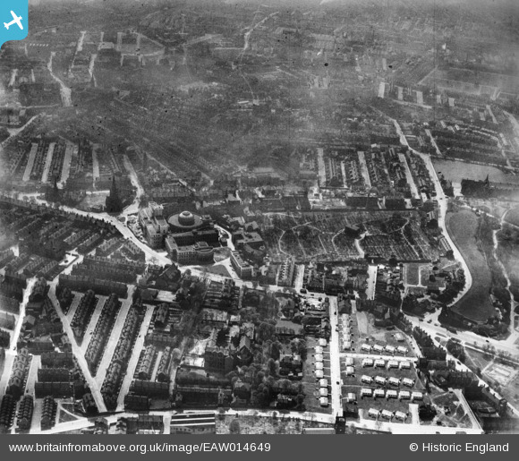
EAW014649 ENGLAND (1948). Woodhouse, Leeds, 1948
© Copyright OpenStreetMap contributors and licensed by the OpenStreetMap Foundation. 2026. Cartography is licensed as CC BY-SA.
Nearby Images (26)
EAW014649

EAW014642

EAW052815

EAW014648

EAW014653

EAW014654

EAW014645

EAW052807

EAW014644

EAW052814

EAW052812

EAW052811

EAW052813

EAW014647

EAW052806

EAW014655

EAW052808

EAW014641

EPW057197

EAW052810

EAW014650

EAW014652

EAW014643

EAW014651

EAW014646

EAW052809

Details
| Title | [EAW014649] Woodhouse, Leeds, 1948 |
| Reference | EAW014649 |
| Date | 21-April-1948 |
| Link | |
| Place name | LEEDS |
| Parish | |
| District | |
| Country | ENGLAND |
| Easting / Northing | 429402, 434721 |
| Longitude / Latitude | -1.5534641922125, 53.807735924062 |
| National Grid Reference | SE294347 |
Pins
Be the first to add a comment to this image!