
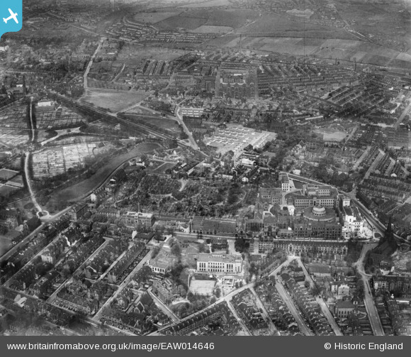
EAW014646 ENGLAND (1948). Woodhouse, Leeds, 1948
© Copyright OpenStreetMap contributors and licensed by the OpenStreetMap Foundation. 2026. Cartography is licensed as CC BY-SA.
Nearby Images (24)
EAW014646

EAW014651

EPW057197

EAW052806

EAW052812

EAW014655

EAW014650

EAW052814

EAW052807

EAW014645

EAW052808

EAW014649

EAW052815

EAW014642

EAW014648

EAW014644

EAW014653

EAW014654

EAW014641

EAW014652

EAW052809

EAW052813

EAW052811

EAW014647

Details
| Title | [EAW014646] Woodhouse, Leeds, 1948 |
| Reference | EAW014646 |
| Date | 21-April-1948 |
| Link | |
| Place name | LEEDS |
| Parish | |
| District | |
| Country | ENGLAND |
| Easting / Northing | 429348, 434902 |
| Longitude / Latitude | -1.554267018335, 53.809365933494 |
| National Grid Reference | SE293349 |
Pins

redmist |
Thursday 11th of October 2018 08:07:31 PM |