
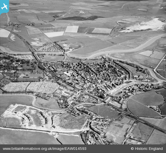
EAW014593 ENGLAND (1948). The town, Rye, from the north-west, 1948
© Copyright OpenStreetMap contributors and licensed by the OpenStreetMap Foundation. 2026. Cartography is licensed as CC BY-SA.
Nearby Images (3)
EAW014593

EAW014594

EPW039357

Details
| Title | [EAW014593] The town, Rye, from the north-west, 1948 |
| Reference | EAW014593 |
| Date | 16-April-1948 |
| Link | |
| Place name | RYE |
| Parish | RYE |
| District | |
| Country | ENGLAND |
| Easting / Northing | 591683, 120608 |
| Longitude / Latitude | 0.72939473681326, 50.952434376905 |
| National Grid Reference | TQ917206 |
Pins

Matt Aldred edob.mattaldred.com |
Saturday 7th of February 2026 08:23:30 PM | |

Sparky |
Sunday 28th of August 2022 02:33:11 PM | |
|
Sparky |
Thursday 10th of August 2017 11:54:36 AM | |
|
Sparky |
Thursday 10th of August 2017 11:53:21 AM | |
|
Sparky |
Thursday 10th of August 2017 11:52:27 AM | |
|
Sparky |
Thursday 10th of August 2017 11:52:00 AM | |

glennhughz |
Wednesday 9th of April 2014 05:35:49 PM |