
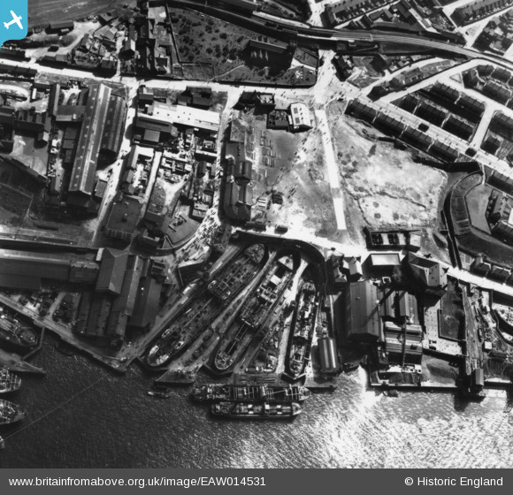
EAW014531 ENGLAND (1948). Middle Docks (Engineering and Ship Repairing), South Shields, 1948. This image has been produced from a print.
© Copyright OpenStreetMap contributors and licensed by the OpenStreetMap Foundation. 2026. Cartography is licensed as CC BY-SA.
Nearby Images (15)
EAW014531
, South Shields, 1948. This image has been produced from a print.")
EAW014532
, South Shields, 1948. This image has been produced from a print.")
EAW014536

EAW008940

EAW014534
, South Shields, 1948. This image has been produced from a print.")
EAW008944

EAW008937

EAW008941

EAW008938

EAW008942

EAW008939

EAW008934

EAW008943

EAW008936

EAW014533
, South Shields, 1948. This image has been produced from a print.")
Details
| Title | [EAW014531] Middle Docks (Engineering and Ship Repairing), South Shields, 1948. This image has been produced from a print. |
| Reference | EAW014531 |
| Date | 15-April-1948 |
| Link | |
| Place name | SOUTH SHIELDS |
| Parish | |
| District | |
| Country | ENGLAND |
| Easting / Northing | 435716, 566485 |
| Longitude / Latitude | -1.4417226495051, 54.991595708716 |
| National Grid Reference | NZ357665 |
Pins

Natalie |
Tuesday 5th of March 2019 03:54:53 AM |