
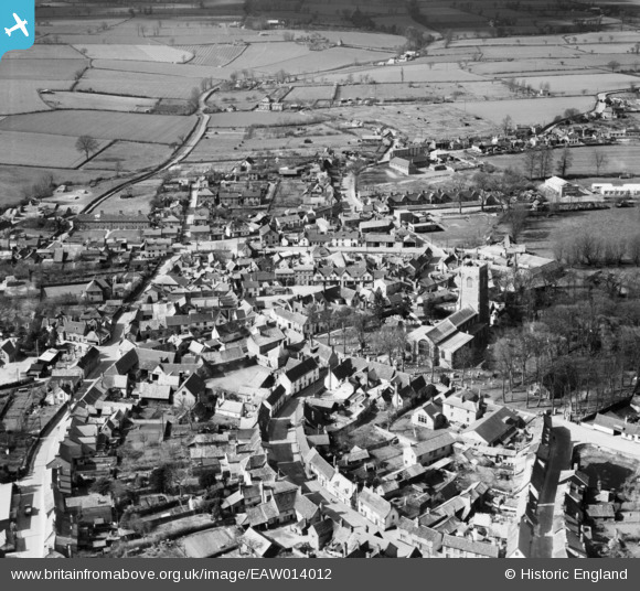
EAW014012 ENGLAND (1948). St Michael's Church and the town centre, Framlingham, 1948
© Copyright OpenStreetMap contributors and licensed by the OpenStreetMap Foundation. 2026. Cartography is licensed as CC BY-SA.
Nearby Images (7)
EAW014012

EAW014011

EAW030400

EAW037247

EAW014014

EAW014017

EAW037245

Details
| Title | [EAW014012] St Michael's Church and the town centre, Framlingham, 1948 |
| Reference | EAW014012 |
| Date | 23-March-1948 |
| Link | |
| Place name | FRAMLINGHAM |
| Parish | FRAMLINGHAM |
| District | |
| Country | ENGLAND |
| Easting / Northing | 628447, 263450 |
| Longitude / Latitude | 1.3449970701102, 52.221399070286 |
| National Grid Reference | TM284635 |
Pins

J May |
Wednesday 13th of March 2024 07:37:36 PM |