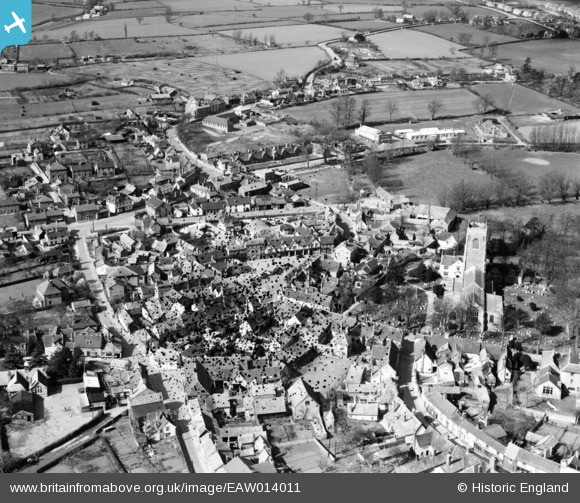
EAW014011 ENGLAND (1948). Market Hill and the town centre, Framlingham, 1948. This image has been produced from a damaged negative.
© Copyright OpenStreetMap contributors and licensed by the OpenStreetMap Foundation. 2026. Cartography is licensed as CC BY-SA.
Nearby Images (7)
Details
| Title | [EAW014011] Market Hill and the town centre, Framlingham, 1948. This image has been produced from a damaged negative. |
| Reference | EAW014011 |
| Date | 23-March-1948 |
| Link | |
| Place name | FRAMLINGHAM |
| Parish | FRAMLINGHAM |
| District | |
| Country | ENGLAND |
| Easting / Northing | 628432, 263460 |
| Longitude / Latitude | 1.3447845919248, 52.221495050698 |
| National Grid Reference | TM284635 |
Pins

J May |
Wednesday 13th of March 2024 07:34:30 PM |


![[EAW014011] Market Hill and the town centre, Framlingham, 1948. This image has been produced from a damaged negative.](http://britainfromabove.org.uk/sites/all/libraries/aerofilms-images/public/100x100/EAW/014/EAW014011.jpg)
![[EAW014012] St Michael's Church and the town centre, Framlingham, 1948](http://britainfromabove.org.uk/sites/all/libraries/aerofilms-images/public/100x100/EAW/014/EAW014012.jpg)
![[EAW030400] Framlingham Castle and the town, Framlingham, 1950](http://britainfromabove.org.uk/sites/all/libraries/aerofilms-images/public/100x100/EAW/030/EAW030400.jpg)
![[EAW037247] Framlingham Castle and town, Framlingham, 1951. This image has been produced from a print.](http://britainfromabove.org.uk/sites/all/libraries/aerofilms-images/public/100x100/EAW/037/EAW037247.jpg)
![[EAW014014] Framlingham Castle and the town, Framlingham, 1948. This image has been produced from a damaged negative.](http://britainfromabove.org.uk/sites/all/libraries/aerofilms-images/public/100x100/EAW/014/EAW014014.jpg)
![[EAW030402] Framlingham Castle, Framlingham, 1950](http://britainfromabove.org.uk/sites/all/libraries/aerofilms-images/public/100x100/EAW/030/EAW030402.jpg)
![[EAW014017] Framlingham Castle and environs, Framlingham, 1948](http://britainfromabove.org.uk/sites/all/libraries/aerofilms-images/public/100x100/EAW/014/EAW014017.jpg)