
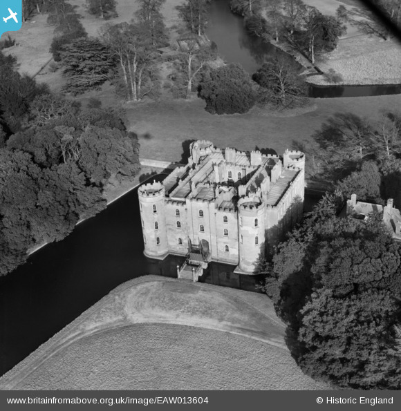
EAW013604 ENGLAND (1948). Shirburn Castle, Shirburn, 1948
© Copyright OpenStreetMap contributors and licensed by the OpenStreetMap Foundation. 2026. Cartography is licensed as CC BY-SA.
Nearby Images (14)
EAW013604

EAW010210

EAW049272

EAW010212

EAW013603

EAW013600

EAW010211

EAW013602

EAW049271

EAW010208

EAW010209

EAW010213

EAW010207

EAW013601

Details
| Title | [EAW013604] Shirburn Castle, Shirburn, 1948 |
| Reference | EAW013604 |
| Date | 9-March-1948 |
| Link | |
| Place name | SHIRBURN |
| Parish | SHIRBURN |
| District | |
| Country | ENGLAND |
| Easting / Northing | 469646, 195987 |
| Longitude / Latitude | -0.99304822633873, 51.657883456959 |
| National Grid Reference | SU696960 |
Pins
Be the first to add a comment to this image!