
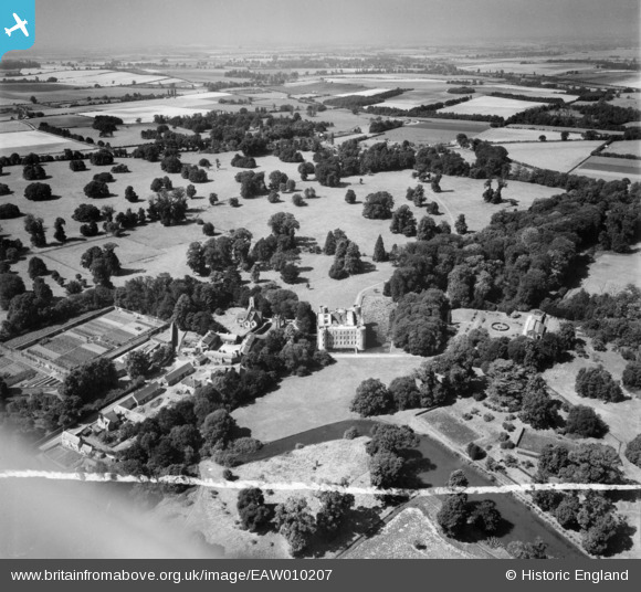
EAW010207 ENGLAND (1947). Shirburn Castle and environs, Shirburn, from the east, 1947. This image was marked by Aerofilms Ltd for photo editing.
© Copyright OpenStreetMap contributors and licensed by the OpenStreetMap Foundation. 2026. Cartography is licensed as CC BY-SA.
Nearby Images (14)
EAW010207

EAW010213

EAW013601

EAW049271

EAW013602

EAW010211

EAW013600

EAW010208

EAW013604

EAW010210

EAW049272

EAW010212

EAW013603

EAW010209

Details
| Title | [EAW010207] Shirburn Castle and environs, Shirburn, from the east, 1947. This image was marked by Aerofilms Ltd for photo editing. |
| Reference | EAW010207 |
| Date | 29-August-1947 |
| Link | |
| Place name | SHIRBURN |
| Parish | SHIRBURN |
| District | |
| Country | ENGLAND |
| Easting / Northing | 469768, 195994 |
| Longitude / Latitude | -0.99128322984295, 51.657931258608 |
| National Grid Reference | SU698960 |
Pins
Be the first to add a comment to this image!