
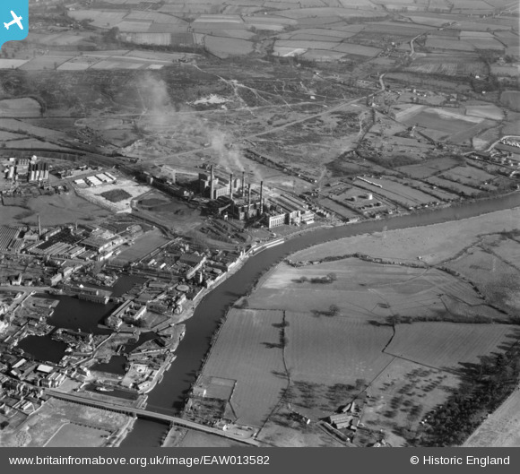
EAW013582 ENGLAND (1948). Stourport Power Station and environs, Stourport-on-Severn, 1948
© Copyright OpenStreetMap contributors and licensed by the OpenStreetMap Foundation. 2026. Cartography is licensed as CC BY-SA.
Nearby Images (22)
EAW013582

EAW013583

EPW015080

EAW013586

EAW013591

EPW015081

EPW041763

EAW013587

EPW041764

EAW013592

EAW013588

EAW013593

EAW013589

EAW013585

EAW013584

EAW013581

EAW013590

EPW061728

EPW061730

EPW061731

EAW013580

EPW061729

Details
| Title | [EAW013582] Stourport Power Station and environs, Stourport-on-Severn, 1948 |
| Reference | EAW013582 |
| Date | 9-March-1948 |
| Link | |
| Place name | STOURPORT-ON-SEVERN |
| Parish | STOURPORT-ON-SEVERN |
| District | |
| Country | ENGLAND |
| Easting / Northing | 381366, 270755 |
| Longitude / Latitude | -2.2735002613258, 52.33417810058 |
| National Grid Reference | SO814708 |
Pins

Doesitmatter |
Friday 20th of January 2023 08:11:06 AM | |
|
redmist |
Monday 1st of November 2021 11:32:42 PM | |
|
redmist |
Monday 1st of November 2021 08:31:01 PM | |
|
redmist |
Monday 1st of November 2021 08:30:37 PM | |
|
redmist |
Monday 1st of November 2021 08:30:08 PM | |
|
redmist |
Monday 1st of November 2021 08:28:54 PM | |
|
redmist |
Monday 1st of November 2021 08:25:55 PM | |
|
redmist |
Monday 1st of November 2021 08:21:28 PM |