
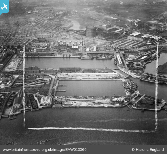
EAW013360 ENGLAND (1948). The East India Docks, Blackwall, 1948. This image was marked by Aerofilms Ltd for photo editing.
© Copyright OpenStreetMap contributors and licensed by the OpenStreetMap Foundation. 2026. Cartography is licensed as CC BY-SA.
Nearby Images (48)
EAW013360

EAW004332

EAW012154

EPW009112

EAW008751

EPW011938

EAW013630

EAW013359

EAW013364

EAW013365

EAW024919

EAW024922

EAW024921
 Dock, Blackwall, 1949. This image was marked by Aerofilms Ltd for photo editing.")
EAW008749

EAW004325

EAW024916

EAW013627

EAW004330

EAW004329

EAW013628

EAW008750

EAW004328

EPW036253

EAW013624

EAW013629

EAW024918

EAW008752

EAW013631

EAW053005
 Power Station, East India Docks and environs, Blackwall, 1953")
EAW013626

EAW004327

EAW008754

EAW024914
 Dock, Blackwall, 1949")
EAW013625

EAW024917

EAW024920

EPW005311

EAW012155
, Blackwall, 1947. This image was marked by Aerofilms Ltd for photo editing.")
EAW013366

EAW004326

EAW013362

EAW024915

EAW013633

EAW004331

EAW012156
, Blackwall, 1947. This image was marked by Aerofilms Ltd for photo editing.")
EAW099748

EAW008753

EAW012157
, Blackwall, 1947. This image was marked by Aerofilms Ltd for photo editing.")
Details
| Title | [EAW013360] The East India Docks, Blackwall, 1948. This image was marked by Aerofilms Ltd for photo editing. |
| Reference | EAW013360 |
| Date | 16-February-1948 |
| Link | |
| Place name | BLACKWALL |
| Parish | |
| District | |
| Country | ENGLAND |
| Easting / Northing | 538774, 180899 |
| Longitude / Latitude | -0.00004395425330056, 51.509472791569 |
| National Grid Reference | TQ388809 |
Pins
Be the first to add a comment to this image!