
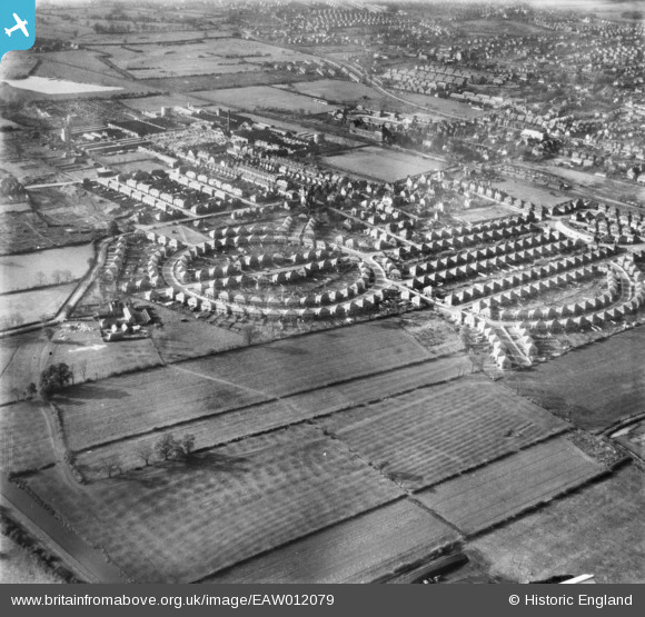
EAW012079 ENGLAND (1947). The residential area surrounding Beech Avenue and Leyton Crescent, Rylands, 1947
© Copyright OpenStreetMap contributors and licensed by the OpenStreetMap Foundation. 2026. Cartography is licensed as CC BY-SA.
Nearby Images (2)
EAW012079

EAW012078

Details
| Title | [EAW012079] The residential area surrounding Beech Avenue and Leyton Crescent, Rylands, 1947 |
| Reference | EAW012079 |
| Date | 5-November-1947 |
| Link | |
| Place name | RYLANDS |
| Parish | |
| District | |
| Country | ENGLAND |
| Easting / Northing | 453933, 336031 |
| Longitude / Latitude | -1.1977758831652, 52.91866884137 |
| National Grid Reference | SK539360 |
Pins
Be the first to add a comment to this image!