
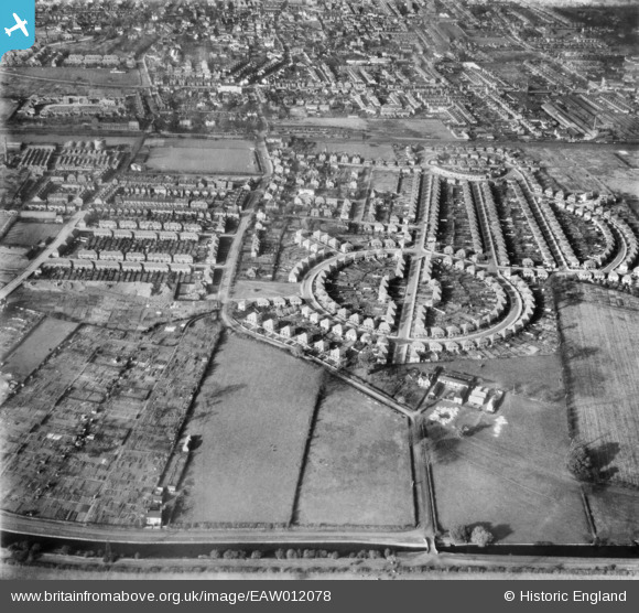
EAW012078 ENGLAND (1947). The residential area surrounding Beech Avenue and Meadow Road, Rylands, 1947
© Copyright OpenStreetMap contributors and licensed by the OpenStreetMap Foundation. 2026. Cartography is licensed as CC BY-SA.
Nearby Images (3)
EAW012078

EAW012079

EAW012086

Details
| Title | [EAW012078] The residential area surrounding Beech Avenue and Meadow Road, Rylands, 1947 |
| Reference | EAW012078 |
| Date | 5-November-1947 |
| Link | |
| Place name | RYLANDS |
| Parish | |
| District | |
| Country | ENGLAND |
| Easting / Northing | 453805, 335916 |
| Longitude / Latitude | -1.1996986711663, 52.917647891494 |
| National Grid Reference | SK538359 |
Pins
Be the first to add a comment to this image!