
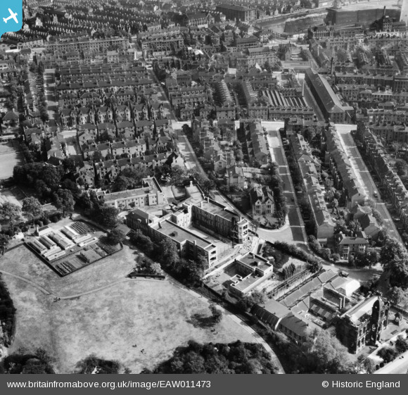
EAW011473 ENGLAND (1947). The Nottingham Hospital for Women on Peel Street and the surrounding residential area, Nottingham, 1947
© Copyright OpenStreetMap contributors and licensed by the OpenStreetMap Foundation. 2026. Cartography is licensed as CC BY-SA.
Nearby Images (8)
EAW011473

EAW011478

EAW011477

EAW011474

EAW011479

EAW011475

EAW011480

EAW011476

Details
| Title | [EAW011473] The Nottingham Hospital for Women on Peel Street and the surrounding residential area, Nottingham, 1947 |
| Reference | EAW011473 |
| Date | 24-September-1947 |
| Link | |
| Place name | NOTTINGHAM |
| Parish | |
| District | |
| Country | ENGLAND |
| Easting / Northing | 456869, 340634 |
| Longitude / Latitude | -1.1533021803385, 52.959743864794 |
| National Grid Reference | SK569406 |
Pins

KC |
Wednesday 25th of August 2021 02:47:58 PM | |
|
KC |
Wednesday 25th of August 2021 02:47:35 PM | |
|
KC |
Wednesday 25th of August 2021 02:44:32 PM | |
|
Riddo27 |
Wednesday 26th of March 2014 04:23:36 PM | |
|
Riddo27 |
Wednesday 26th of March 2014 04:22:06 PM | |
|
Riddo27 |
Wednesday 26th of March 2014 04:19:29 PM | |
|
Riddo27 |
Wednesday 26th of March 2014 04:12:23 PM | |
|
Riddo27 |
Wednesday 26th of March 2014 04:10:25 PM | |
|
Riddo27 |
Wednesday 26th of March 2014 04:08:28 PM | |
|
Riddo27 |
Wednesday 26th of March 2014 04:06:10 PM |