
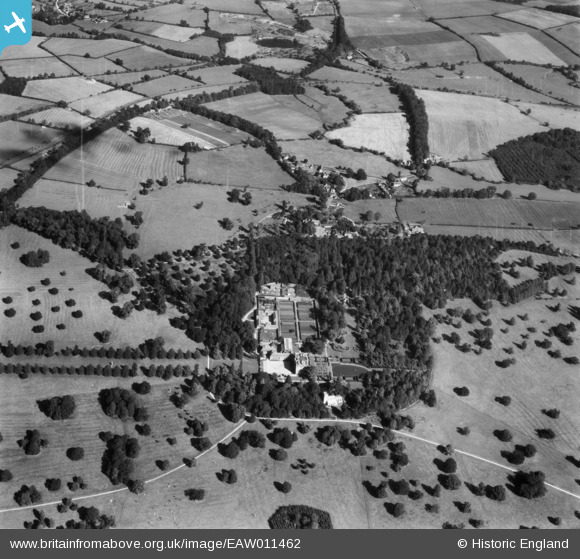
EAW011462 ENGLAND (1947). Easton Neston House and St Mary's Church, Easton Neston Park, 1947
© Copyright OpenStreetMap contributors and licensed by the OpenStreetMap Foundation. 2026. Cartography is licensed as CC BY-SA.
Nearby Images (4)
EAW011462

EAW011463

EAW011461

EAW011464

Details
| Title | [EAW011462] Easton Neston House and St Mary's Church, Easton Neston Park, 1947 |
| Reference | EAW011462 |
| Date | 24-September-1947 |
| Link | |
| Place name | EASTON NESTON PARK |
| Parish | EASTON NESTON |
| District | |
| Country | ENGLAND |
| Easting / Northing | 470241, 249539 |
| Longitude / Latitude | -0.97353240854203, 52.13926687753 |
| National Grid Reference | SP702495 |
Pins
Be the first to add a comment to this image!