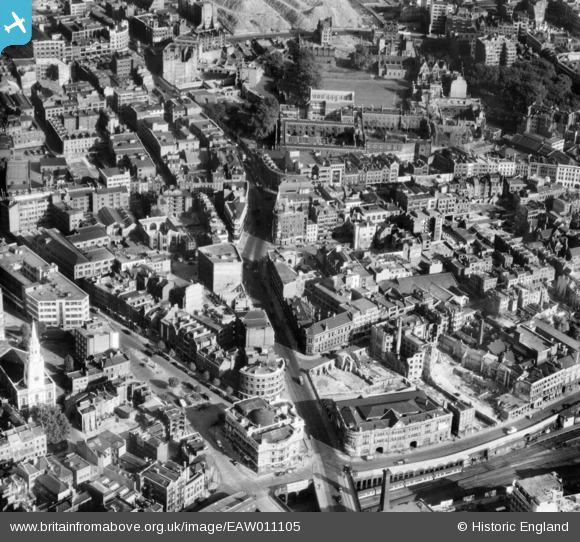
EAW011105 ENGLAND (1947). Clerkenwell Green, Clerkenwell Road and environs, Clerkenwell, 1947
    © Copyright OpenStreetMap contributors and licensed by the OpenStreetMap Foundation. 2025. Cartography is licensed as CC BY-SA.
  
Nearby Images (8)
Details
| Title | [EAW011105] Clerkenwell Green, Clerkenwell Road and environs, Clerkenwell, 1947 | 
| Reference | EAW011105 | 
| Date | 30-October-1947 | 
| Link | |
| Place name | CLERKENWELL | 
| Parish | |
| District | |
| Country | ENGLAND | 
| Easting / Northing | 531673, 182094 | 
| Longitude / Latitude | -0.1018722295938, 51.521912603466 | 
| National Grid Reference | TQ317821 | 
Pins
| Class31 | Tuesday 22nd of July 2014 09:04:54 PM | |
| Class31 | Tuesday 22nd of July 2014 09:02:09 PM | |
|  Farringdon Lane, EC1 |   billyfern | Tuesday 8th of July 2014 06:03:16 PM | 
|  Clerkenwell Close, EC1 |   billyfern | Tuesday 8th of July 2014 06:02:54 PM | 
|  Goswell Road & Clerkenwell Road Junction, EC1 |   billyfern | Tuesday 8th of July 2014 05:56:29 PM | 
|  St. John Street, EC1 |   billyfern | Tuesday 8th of July 2014 05:55:48 PM | 
|  Turnmill Street, EC1 |   billyfern | Tuesday 8th of July 2014 05:55:12 PM | 
|  Old Session House, Clerkenwell Green & Clerkenwell Road & Farringdon Lane, EC1 |   billyfern | Tuesday 8th of July 2014 05:54:32 PM | 
| Class31 | Tuesday 8th of July 2014 05:52:49 PM | |
| Class31 | Tuesday 8th of July 2014 05:51:15 PM | |
| Class31 | Tuesday 17th of June 2014 08:25:02 PM | |
| Class31 | Tuesday 17th of June 2014 08:22:50 PM | |
| Class31 | Tuesday 17th of June 2014 08:20:46 PM | |
| Class31 | Tuesday 17th of June 2014 07:43:46 PM | |
|  Clerkenwell Road | Class31 | Monday 12th of May 2014 12:32:50 PM | 
|   Alan McFaden | Monday 21st of April 2014 06:33:44 PM | |
|  Booth' s Gin Distillery, Turnmill Street |   downloader141 | Saturday 29th of March 2014 12:36:04 AM | 
|  The Crown Public House |   downloader141 | Saturday 29th of March 2014 12:34:26 AM | 
|  Clerkenwell Green |   downloader141 | Saturday 29th of March 2014 12:33:32 AM | 
|  Charterhouse |   FandF | Wednesday 1st of January 2014 10:14:39 PM | 
|   Alan McFaden | Thursday 7th of November 2013 11:05:38 AM | 
 
             
  ![[EAW011105] Clerkenwell Green, Clerkenwell Road and environs, Clerkenwell, 1947](http://britainfromabove.org.uk/sites/all/libraries/aerofilms-images/public/100x100/EAW/011/EAW011105.jpg) 
  
                                          ![[EAW011204] The area between Farringdon Station and the junction of Clerkenwell Road and St John Street, Clerkenwell, 1947](http://britainfromabove.org.uk/sites/all/libraries/aerofilms-images/public/100x100/EAW/011/EAW011204.jpg) 
 ![[EAW011100] The area between Turnmill Street, Clerkenwell Road and Charterhouse, Clerkenwell, 1947](http://britainfromabove.org.uk/sites/all/libraries/aerofilms-images/public/100x100/EAW/011/EAW011100.jpg) 
 ![[EAW011213] The Cannon Brewery, St John Street and environs, St Luke's, 1947](http://britainfromabove.org.uk/sites/all/libraries/aerofilms-images/public/100x100/EAW/011/EAW011213.jpg) 
 ![[EAW011104] Sekforde Street, Compton Street and environs, St Luke's, 1947](http://britainfromabove.org.uk/sites/all/libraries/aerofilms-images/public/100x100/EAW/011/EAW011104.jpg) 
 ![[EAW011203] St Bartholomew's Medical College, Smithfield Market (London Central Markets) and environs, St Luke's, 1947](http://britainfromabove.org.uk/sites/all/libraries/aerofilms-images/public/100x100/EAW/011/EAW011203.jpg) 
 ![[EAW010076] Farringdon Road, Farringdon Station and environs, Holborn, 1947](http://britainfromabove.org.uk/sites/all/libraries/aerofilms-images/public/100x100/EAW/010/EAW010076.jpg) 
 ![[EAW011212] St James's Church, the Hugh Myddleton Secondary School and environs, Clerkenwell, 1947](http://britainfromabove.org.uk/sites/all/libraries/aerofilms-images/public/100x100/EAW/011/EAW011212.jpg) 
 
