
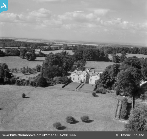
EAW010992 ENGLAND (1947). Farleigh House, Farleigh Wallop, from the east, 1947
© Copyright OpenStreetMap contributors and licensed by the OpenStreetMap Foundation. 2025. Cartography is licensed as CC BY-SA.
Nearby Images (23)
EAW010992

EAW046165

EAW010985

EAW010984

EAW010993

EAW010989

EAW010998

EAW010994

EAW010995

EAW010996

EAW010986

EAW010983

EAW010990

EAW010991

EAW011000

EAW010987

EAW010988

EAW046167

EAW046166

EAW010999

EAW046163

EAW046168

EAW046164

Details
| Title | [EAW010992] Farleigh House, Farleigh Wallop, from the east, 1947 |
| Reference | EAW010992 |
| Date | 24-September-1947 |
| Link | |
| Place name | FARLEIGH WALLOP |
| Parish | FARLEIGH WALLOP |
| District | |
| Country | ENGLAND |
| Easting / Northing | 462221, 146642 |
| Longitude / Latitude | -1.1090590397995, 51.215068877226 |
| National Grid Reference | SU622466 |
Pins
Be the first to add a comment to this image!