
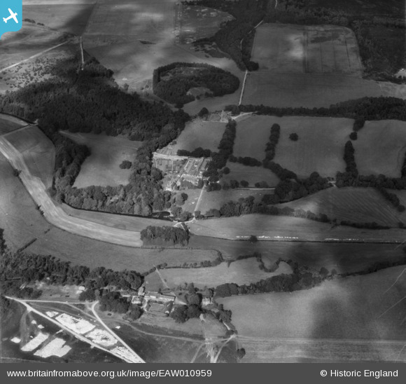
EAW010959 ENGLAND (1947). Trigon House and Farm, Trigon Hill, 1947
© Copyright OpenStreetMap contributors and licensed by the OpenStreetMap Foundation. 2026. Cartography is licensed as CC BY-SA.
Nearby Images (5)
EAW010959

EAW010957

EAW010956

EAW010953

EAW010960

Details
| Title | [EAW010959] Trigon House and Farm, Trigon Hill, 1947 |
| Reference | EAW010959 |
| Date | 24-September-1947 |
| Link | |
| Place name | TRIGON HILL |
| Parish | WAREHAM ST. MARTIN |
| District | |
| Country | ENGLAND |
| Easting / Northing | 388496, 88662 |
| Longitude / Latitude | -2.16290238504, 50.696912404786 |
| National Grid Reference | SY885887 |
Pins
Be the first to add a comment to this image!