
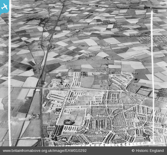
EAW010292 ENGLAND (1947). Development around West Chirton and Billy Mill, West Chirton, from the south, 1947. This image was marked by Aerofilms Ltd for photo editing.
© Copyright OpenStreetMap contributors and licensed by the OpenStreetMap Foundation. 2026. Cartography is licensed as CC BY-SA.
Nearby Images (2)
EAW010292

EAW010283

Details
| Title | [EAW010292] Development around West Chirton and Billy Mill, West Chirton, from the south, 1947. This image was marked by Aerofilms Ltd for photo editing. |
| Reference | EAW010292 |
| Date | 24-August-1947 |
| Link | |
| Place name | WEST CHIRTON |
| Parish | |
| District | |
| Country | ENGLAND |
| Easting / Northing | 433757, 568218 |
| Longitude / Latitude | -1.4721378927107, 55.007306554565 |
| National Grid Reference | NZ338682 |
Pins
Be the first to add a comment to this image!