
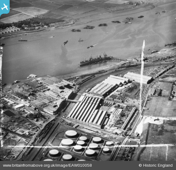
EAW010058 ENGLAND (1947). Thames Board Mills, Purfleet, 1947. This image was marked by Aerofilms Ltd for photo editing.
© Copyright OpenStreetMap contributors and licensed by the OpenStreetMap Foundation. 2026. Cartography is licensed as CC BY-SA.
Nearby Images (28)
EAW010058

EAW011783

EAW010061

EAW010060

EAW011784

EAW011777

EAW010064

EAW011779

EAW010057

EAW011778

EAW010067

EAW010050

EAW011780

EAW010062

EAW011782

EAW011785

EAW010054

EAW010049

EAW010059

EAW010053

EAW010055

EAW011781

EAW011776

EAW010066

EAW010063

EAW010065

EAW050475

EAW010052

Details
| Title | [EAW010058] Thames Board Mills, Purfleet, 1947. This image was marked by Aerofilms Ltd for photo editing. |
| Reference | EAW010058 |
| Date | 6-September-1947 |
| Link | |
| Place name | PURFLEET |
| Parish | |
| District | |
| Country | ENGLAND |
| Easting / Northing | 555744, 177746 |
| Longitude / Latitude | 0.24293876041998, 51.47671826226 |
| National Grid Reference | TQ557777 |

