
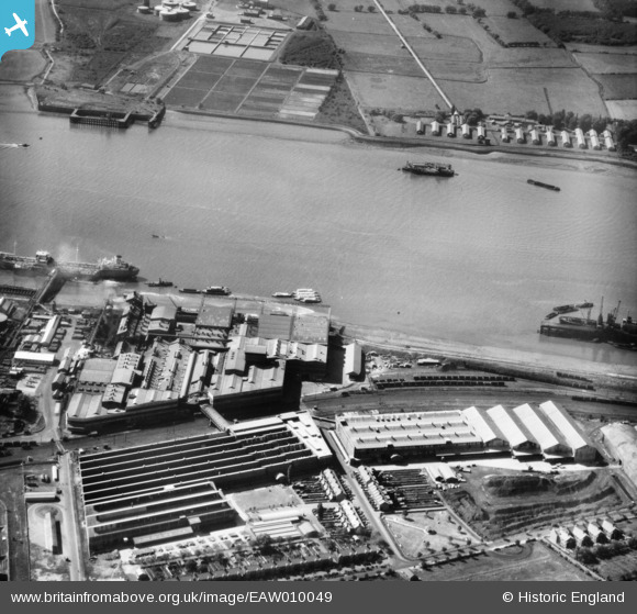
EAW010049 ENGLAND (1947). Thames Board Mills, Purfleet, 1947
© Copyright OpenStreetMap contributors and licensed by the OpenStreetMap Foundation. 2026. Cartography is licensed as CC BY-SA.
Nearby Images (29)
EAW010049

EAW011783

EAW024361

EPW026368

EAW048218

EAW024365

EAW010058

EAW010062

EAW010061

EAW010050

EAW024366

EAW011779

EAW010060

EAW010063

EAW024368

EAW011784

EAW024367

EAW024362

EAW024369

EAW024359

EAW024363

EAW024364

EAW010053

EAW011785

EAW011781

EAW010064

EAW011780

EAW010059

EAW010054

Details
| Title | [EAW010049] Thames Board Mills, Purfleet, 1947 |
| Reference | EAW010049 |
| Date | 6-September-1947 |
| Link | |
| Place name | PURFLEET |
| Parish | |
| District | |
| Country | ENGLAND |
| Easting / Northing | 555725, 177544 |
| Longitude / Latitude | 0.24257630603183, 51.474908392171 |
| National Grid Reference | TQ557775 |
Pins

MB |
Monday 23rd of December 2013 10:32:22 PM |