
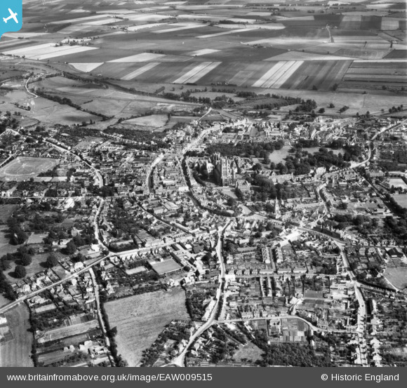
EAW009515 ENGLAND (1947). The city centre, Ely, from the north-west, 1947
© Copyright OpenStreetMap contributors and licensed by the OpenStreetMap Foundation. 2025. Cartography is licensed as CC BY-SA.
Nearby Images (2)
EAW009515

EAW009516

Details
| Title | [EAW009515] The city centre, Ely, from the north-west, 1947 |
| Reference | EAW009515 |
| Date | 18-August-1947 |
| Link | |
| Place name | ELY |
| Parish | ELY |
| District | |
| Country | ENGLAND |
| Easting / Northing | 553660, 280519 |
| Longitude / Latitude | 0.25887969363946, 52.400701875515 |
| National Grid Reference | TL537805 |
Pins

Matt Aldred edob.mattaldred.com |
Wednesday 12th of June 2024 02:39:14 PM | |
|
Matt Aldred edob.mattaldred.com |
Wednesday 12th of June 2024 02:38:35 PM | |

Jim Cain |
Wednesday 20th of February 2019 10:11:52 AM | |
|
The Laird |
Saturday 3rd of February 2018 09:58:58 PM |