
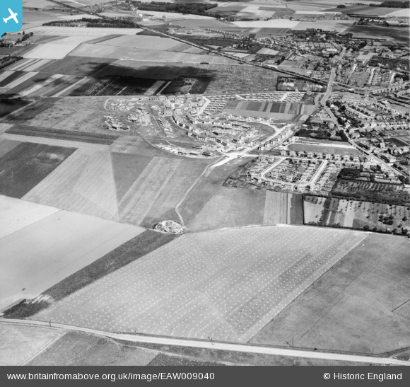
EAW009040 ENGLAND (1947). The residential area at Newington (surrounding Melbourne Avenue) under construction, Ramsgate, 1947
© Copyright OpenStreetMap contributors and licensed by the OpenStreetMap Foundation. 2026. Cartography is licensed as CC BY-SA.
Nearby Images (3)
EAW009040
 under construction, Ramsgate, 1947")
EAW009041
 under construction and the surrounding area, Ramsgate, 1947")
EPW043753

Details
| Title | [EAW009040] The residential area at Newington (surrounding Melbourne Avenue) under construction, Ramsgate, 1947 |
| Reference | EAW009040 |
| Date | 12-August-1947 |
| Link | |
| Place name | RAMSGATE |
| Parish | RAMSGATE |
| District | |
| Country | ENGLAND |
| Easting / Northing | 636470, 166008 |
| Longitude / Latitude | 1.3958605799816, 51.343378219248 |
| National Grid Reference | TR365660 |
Pins
Be the first to add a comment to this image!