
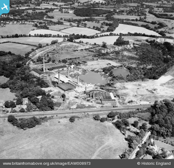
EAW008973 ENGLAND (1947). The Keymer Brick and Tile Works, Burgess Hill, 1947
© Copyright OpenStreetMap contributors and licensed by the OpenStreetMap Foundation. 2026. Cartography is licensed as CC BY-SA.
Nearby Images (9)
EAW008973

EAW008979

EAW008981

EAW008975

EAW008980

EAW008978

EAW008982

EAW008976

EAW008974

Details
| Title | [EAW008973] The Keymer Brick and Tile Works, Burgess Hill, 1947 |
| Reference | EAW008973 |
| Date | 12-August-1947 |
| Link | |
| Place name | BURGESS HILL |
| Parish | BURGESS HILL |
| District | |
| Country | ENGLAND |
| Easting / Northing | 532292, 119292 |
| Longitude / Latitude | -0.11615987796576, 50.957304651061 |
| National Grid Reference | TQ323193 |
Pins

Geoff Smith |
Tuesday 21st of July 2020 09:42:58 AM | |
|
Paul |
Saturday 16th of February 2019 11:11:39 AM |