
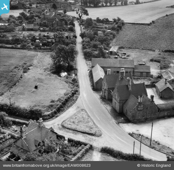
EAW008623 ENGLAND (1947). The Lamb Inn and Shrewsbury Road, Edgmond, 1947
© Copyright OpenStreetMap contributors and licensed by the OpenStreetMap Foundation. 2026. Cartography is licensed as CC BY-SA.
Nearby Images (9)
EAW008623

EAW006708

EAW008622

EAW008621

EAW006707

EAW006706

EAW008624

EAW008620

EAW008619

Details
| Title | [EAW008623] The Lamb Inn and Shrewsbury Road, Edgmond, 1947 |
| Reference | EAW008623 |
| Date | 1-August-1947 |
| Link | |
| Place name | EDGMOND |
| Parish | EDGMOND |
| District | |
| Country | ENGLAND |
| Easting / Northing | 372304, 320000 |
| Longitude / Latitude | -2.4106171004679, 52.776540639253 |
| National Grid Reference | SJ723200 |
Pins

Andrew Bennett |
Tuesday 6th of May 2014 12:18:44 AM |