
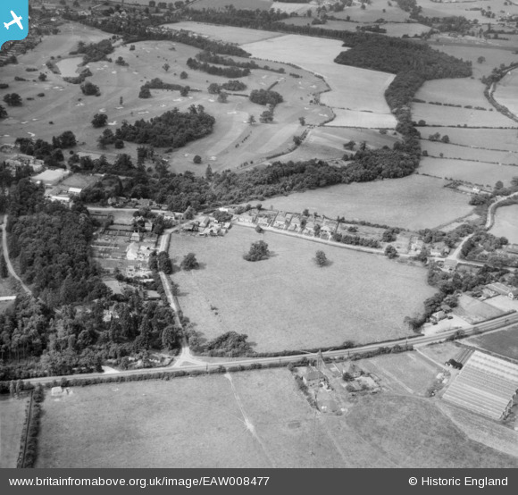
EAW008477 ENGLAND (1947). Bell Lane and Brookmans Park Golf Course, Brookmans Park, 1947
© Copyright OpenStreetMap contributors and licensed by the OpenStreetMap Foundation. 2026. Cartography is licensed as CC BY-SA.
Nearby Images (4)
EAW008477

EAW008460

EAW008459

EAW008478

Details
| Title | [EAW008477] Bell Lane and Brookmans Park Golf Course, Brookmans Park, 1947 |
| Reference | EAW008477 |
| Date | 31-July-1947 |
| Link | |
| Place name | BROOKMANS PARK |
| Parish | NORTH MYMMS |
| District | |
| Country | ENGLAND |
| Easting / Northing | 525348, 205046 |
| Longitude / Latitude | -0.1847836067837, 51.72964040987 |
| National Grid Reference | TL253050 |
Pins

Ray Flack |
Wednesday 17th of September 2014 12:44:55 PM | |
|
Ray Flack |
Wednesday 17th of September 2014 12:43:40 PM | |
|
Ray Flack |
Wednesday 17th of September 2014 12:42:54 PM | |
|
Ray Flack |
Wednesday 17th of September 2014 12:42:27 PM | |
|
Ray Flack |
Wednesday 17th of September 2014 12:42:03 PM | |
|
Ray Flack |
Wednesday 17th of September 2014 12:41:16 PM | |
|
Ray Flack |
Wednesday 17th of September 2014 12:40:46 PM |