
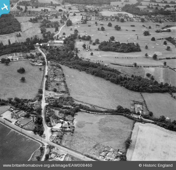
EAW008460 ENGLAND (1947). Bell Lane, The Legg and Brookmans Park Golf Course, Bell Bar, 1947
© Copyright OpenStreetMap contributors and licensed by the OpenStreetMap Foundation. 2026. Cartography is licensed as CC BY-SA.
Nearby Images (3)
EAW008460

EAW008478

EAW008477

Details
| Title | [EAW008460] Bell Lane, The Legg and Brookmans Park Golf Course, Bell Bar, 1947 |
| Reference | EAW008460 |
| Date | 31-July-1947 |
| Link | |
| Place name | BELL BAR |
| Parish | NORTH MYMMS |
| District | |
| Country | ENGLAND |
| Easting / Northing | 525190, 205094 |
| Longitude / Latitude | -0.18705317025599, 51.730107127514 |
| National Grid Reference | TL252051 |
Pins
Be the first to add a comment to this image!