
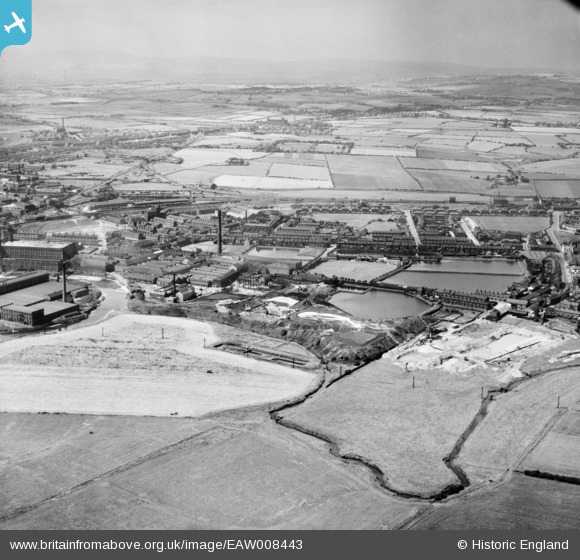
EAW008443 ENGLAND (1947). The East Lancashire Paper Mill, Radcliffe, from the south-east, 1947
© Copyright OpenStreetMap contributors and licensed by the OpenStreetMap Foundation. 2025. Cartography is licensed as CC BY-SA.
Nearby Images (3)
EAW008443

EAW008449

EAW008444

Details
| Title | [EAW008443] The East Lancashire Paper Mill, Radcliffe, from the south-east, 1947 |
| Reference | EAW008443 |
| Date | 22-July-1947 |
| Link | |
| Place name | RADCLIFFE |
| Parish | |
| District | |
| Country | ENGLAND |
| Easting / Northing | 379550, 407208 |
| Longitude / Latitude | -2.3087677228027, 53.560849204234 |
| National Grid Reference | SD796072 |
Pins

andy |
Wednesday 19th of August 2020 11:29:25 PM | |
|
andy |
Wednesday 19th of August 2020 11:28:37 PM | |
|
andy |
Wednesday 19th of August 2020 11:27:39 PM | |
|
andy |
Wednesday 19th of August 2020 11:26:56 PM | |
|
andy |
Wednesday 19th of August 2020 11:26:05 PM | |
|
Barney Rubble |
Saturday 11th of April 2020 01:59:48 PM | |
|
boltie |
Saturday 21st of December 2013 05:09:49 PM |