
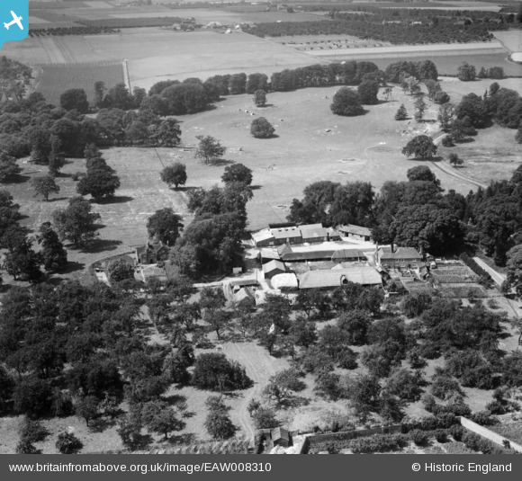
EAW008310 ENGLAND (1947). Home Farm, Woodstock, 1947
© Copyright OpenStreetMap contributors and licensed by the OpenStreetMap Foundation. 2026. Cartography is licensed as CC BY-SA.
Nearby Images (10)
EAW008310

EAW008295

EAW008308

EAW008311

EAW008313

EAW008298

EAW008302

EAW008297

EAW008307

EAW008304

Details
| Title | [EAW008310] Home Farm, Woodstock, 1947 |
| Reference | EAW008310 |
| Date | 15-July-1947 |
| Link | |
| Place name | WOODSTOCK |
| Parish | TUNSTALL |
| District | |
| Country | ENGLAND |
| Easting / Northing | 590033, 160733 |
| Longitude / Latitude | 0.72709247994506, 51.313421881277 |
| National Grid Reference | TQ900607 |
Pins
User Comment Contributions
Thank you! We'll update the catalogue and post the new data here in due course. Yours, Katy Britain from Above Cataloguing Team Leader |
Katy Whitaker |
Tuesday 7th of January 2014 01:17:51 PM |
In the set EAW008294, EAW008296 - EAW008308, EAW008310 - EAW008311, EAW008313. All taken in same area with oast houses and orchards. Kent? |

Rebecca |
Monday 4th of November 2013 02:04:10 PM |