
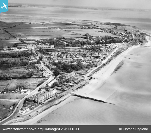
EAW008108 ENGLAND (1947). Hall Lane, Cliff Parade and The Naze, Walton-on-the-Naze, from the south-east, 1947
© Copyright OpenStreetMap contributors and licensed by the OpenStreetMap Foundation. 2026. Cartography is licensed as CC BY-SA.
Nearby Images (2)
EAW008108

EAW008107

Details
| Title | [EAW008108] Hall Lane, Cliff Parade and The Naze, Walton-on-the-Naze, from the south-east, 1947 |
| Reference | EAW008108 |
| Date | 12-July-1947 |
| Link | |
| Place name | WALTON-ON-THE-NAZE |
| Parish | FRINTON AND WALTON |
| District | |
| Country | ENGLAND |
| Easting / Northing | 625968, 222418 |
| Longitude / Latitude | 1.2816519884658, 51.854085341203 |
| National Grid Reference | TM260224 |
Pins

redmist |
Monday 2nd of March 2020 07:44:08 PM | |

Sparky |
Wednesday 9th of August 2017 11:12:50 PM | |
|
cptpies |
Thursday 28th of November 2013 11:48:18 AM |