
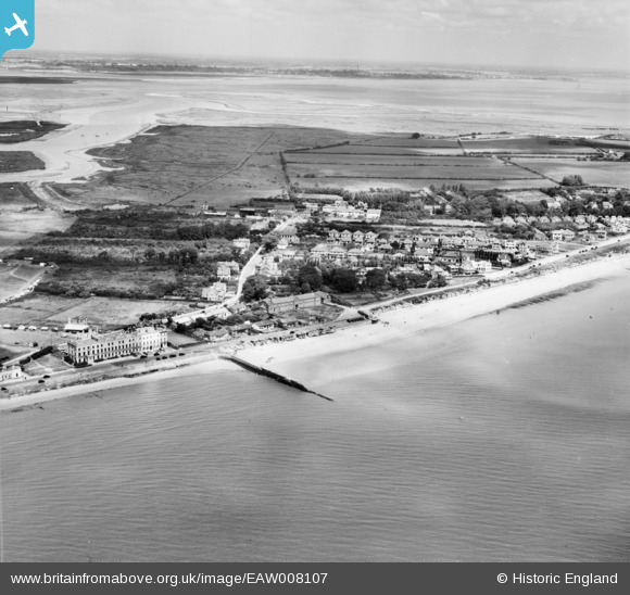
EAW008107 ENGLAND (1947). The coastguard station, Hall Lane and environs, Walton-on-the-Naze, from the south-east, 1947
© Copyright OpenStreetMap contributors and licensed by the OpenStreetMap Foundation. 2026. Cartography is licensed as CC BY-SA.
Nearby Images (2)
EAW008107

EAW008108

Details
| Title | [EAW008107] The coastguard station, Hall Lane and environs, Walton-on-the-Naze, from the south-east, 1947 |
| Reference | EAW008107 |
| Date | 12-July-1947 |
| Link | |
| Place name | WALTON-ON-THE-NAZE |
| Parish | FRINTON AND WALTON |
| District | |
| Country | ENGLAND |
| Easting / Northing | 626019, 222355 |
| Longitude / Latitude | 1.2823501387522, 51.853499129968 |
| National Grid Reference | TM260224 |
Pins
Be the first to add a comment to this image!