
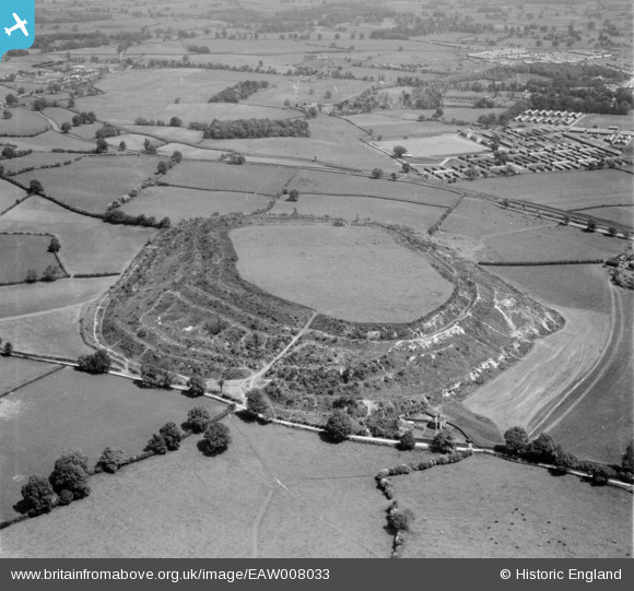
EAW008033 ENGLAND (1947). The hillfort, Old Oswestry, 1947
© Copyright OpenStreetMap contributors and licensed by the OpenStreetMap Foundation. 2025. Cartography is licensed as CC BY-SA.
Nearby Images (2)
EAW008033

EAW008032

Details
| Title | [EAW008033] The hillfort, Old Oswestry, 1947 |
| Reference | EAW008033 |
| Date | 30-May-1947 |
| Link | |
| Place name | OLD OSWESTRY |
| Parish | SELATTYN AND GOBOWEN |
| District | |
| Country | ENGLAND |
| Easting / Northing | 329503, 330984 |
| Longitude / Latitude | -3.0474704533547, 52.871383306753 |
| National Grid Reference | SJ295310 |
Pins

Robin |
Tuesday 6th of January 2015 10:08:44 PM | |
|
MB |
Wednesday 13th of November 2013 10:43:12 AM | |
|
MB |
Wednesday 13th of November 2013 10:41:54 AM | |
|
MB |
Wednesday 13th of November 2013 10:41:10 AM | |
|
MB |
Wednesday 13th of November 2013 10:33:50 AM |
User Comment Contributions
In the care of English Heritage |
MB |
Wednesday 13th of November 2013 10:32:08 AM |