
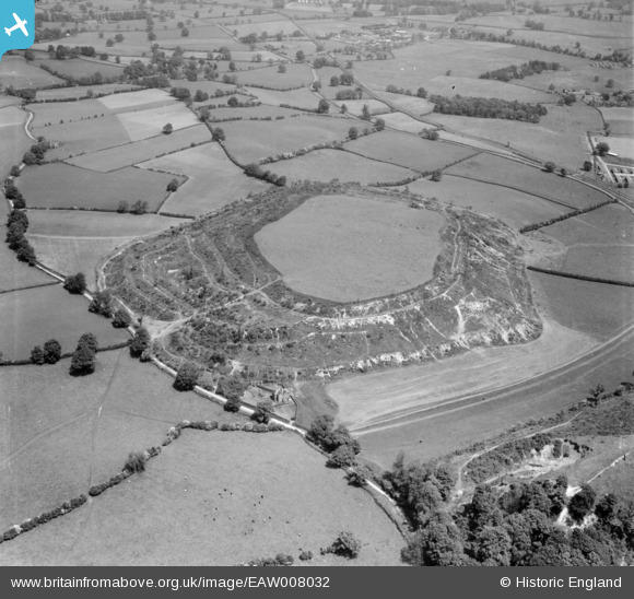
EAW008032 ENGLAND (1947). The hillfort, Old Oswestry, 1947
© Copyright OpenStreetMap contributors and licensed by the OpenStreetMap Foundation. 2025. Cartography is licensed as CC BY-SA.
Nearby Images (2)
EAW008032

EAW008033

Details
| Title | [EAW008032] The hillfort, Old Oswestry, 1947 |
| Reference | EAW008032 |
| Date | 30-May-1947 |
| Link | |
| Place name | OLD OSWESTRY |
| Parish | SELATTYN AND GOBOWEN |
| District | |
| Country | ENGLAND |
| Easting / Northing | 329464, 330893 |
| Longitude / Latitude | -3.048030106926, 52.870560204366 |
| National Grid Reference | SJ295309 |
Pins
Be the first to add a comment to this image!