
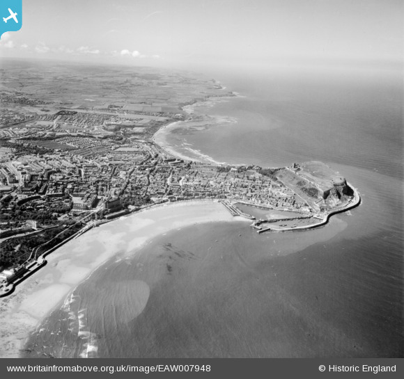
EAW007948 ENGLAND (1947). South Bay, the headland and North Bay, Scarborough, from the south-east, 1947
© Copyright OpenStreetMap contributors and licensed by the OpenStreetMap Foundation. 2026. Cartography is licensed as CC BY-SA.
Nearby Images (7)
EAW007948

EAW007941

EAW016694

EAW016688

EAW016690

EPW029089

EAW016689

Details
| Title | [EAW007948] South Bay, the headland and North Bay, Scarborough, from the south-east, 1947 |
| Reference | EAW007948 |
| Date | 26-June-1947 |
| Link | |
| Place name | SCARBOROUGH |
| Parish | |
| District | |
| Country | ENGLAND |
| Easting / Northing | 504877, 488427 |
| Longitude / Latitude | -0.38896133416403, 54.280549716613 |
| National Grid Reference | TA049884 |
Pins

redmist |
Thursday 12th of September 2019 08:14:41 PM | |
|
redmist |
Thursday 12th of September 2019 08:13:58 PM | |
|
garfield70 |
Thursday 2nd of July 2015 12:47:24 PM | |
|
Chells809 |
Monday 24th of March 2014 09:42:06 PM | |
|
Chells809 |
Monday 24th of March 2014 09:40:55 PM | |
|
Chells809 |
Monday 24th of March 2014 09:39:12 PM | |
|
Chells809 |
Monday 24th of March 2014 09:38:00 PM | |

Alan McFaden |
Thursday 9th of January 2014 11:44:47 AM | |
|
Alan McFaden |
Thursday 9th of January 2014 11:44:20 AM | |
|
Alan McFaden |
Thursday 9th of January 2014 11:43:48 AM | |
|
Alan McFaden |
Thursday 9th of January 2014 11:43:13 AM |


