
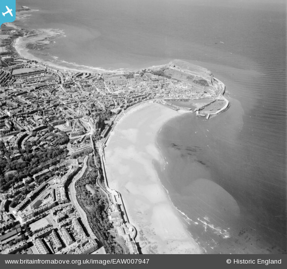
EAW007947 ENGLAND (1947). The town centre, South Bay and the headland, Scarborough, from the south, 1947
© Copyright OpenStreetMap contributors and licensed by the OpenStreetMap Foundation. 2026. Cartography is licensed as CC BY-SA.
Nearby Images (7)
EAW007947

EAW007945

EAW007954

EAW016691

EPW038932

EAW007953

EAW007944

Details
| Title | [EAW007947] The town centre, South Bay and the headland, Scarborough, from the south, 1947 |
| Reference | EAW007947 |
| Date | 26-June-1947 |
| Link | |
| Place name | SCARBOROUGH |
| Parish | |
| District | |
| Country | ENGLAND |
| Easting / Northing | 504552, 488066 |
| Longitude / Latitude | -0.39407772425893, 54.277372793323 |
| National Grid Reference | TA046881 |
Pins

redmist |
Monday 9th of March 2020 08:11:31 PM | |
|
redmist |
Thursday 12th of September 2019 08:13:22 PM | |
|
redmist |
Thursday 12th of September 2019 08:11:51 PM | |

Alan McFaden |
Thursday 9th of January 2014 11:53:27 AM | |
|
Alan McFaden |
Thursday 9th of January 2014 11:52:51 AM | |
|
Alan McFaden |
Thursday 9th of January 2014 11:52:25 AM | |
|
Alan McFaden |
Thursday 9th of January 2014 11:51:48 AM |


