
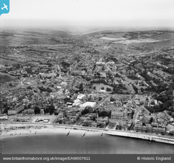
EAW007611 ENGLAND (1947). The town, Dover, from the south-east, 1947
© Copyright OpenStreetMap contributors and licensed by the OpenStreetMap Foundation. 2026. Cartography is licensed as CC BY-SA.
Nearby Images (22)
EAW007611

EPW038152

EAW007612

EPW039372

EAW007609

EPW039375

EPW038153

EPW039371

EAW007617

EPW038155

EPW000356

EAW007618

EPW019057

EPW035420

EAW007610

EPW039376

EPW000767

EPW000773

EPW000371

EPW035419

EAW007606

EPW000579

Details
| Title | [EAW007611] The town, Dover, from the south-east, 1947 |
| Reference | EAW007611 |
| Date | 28-June-1947 |
| Link | |
| Place name | DOVER |
| Parish | DOVER |
| District | |
| Country | ENGLAND |
| Easting / Northing | 632152, 141375 |
| Longitude / Latitude | 1.3180026100321, 51.124009085037 |
| National Grid Reference | TR322414 |
Pins

Post-war prefabs |
Friday 25th of October 2019 11:51:22 AM | |

Alan McFaden |
Wednesday 9th of July 2014 05:45:14 PM | |
|
Alan McFaden |
Wednesday 9th of July 2014 05:44:24 PM | |
|
Alan McFaden |
Wednesday 9th of July 2014 05:43:55 PM | |
|
Alan McFaden |
Wednesday 9th of July 2014 05:43:19 PM | |
|
Alan McFaden |
Wednesday 9th of July 2014 05:42:43 PM |


