
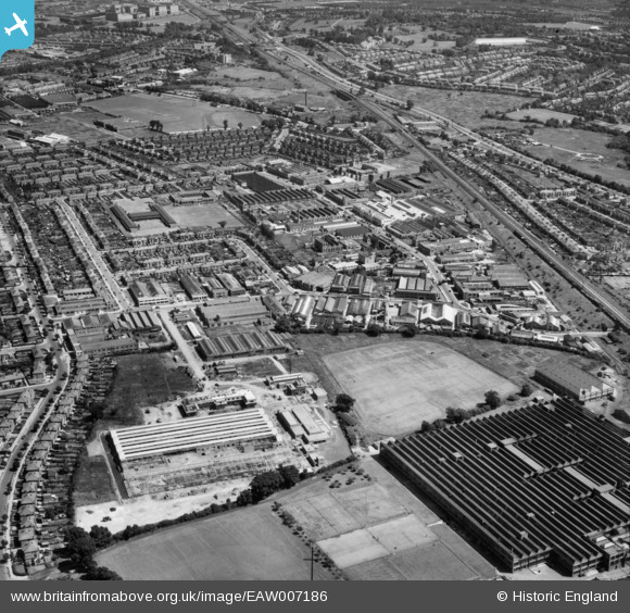
EAW007186 ENGLAND (1947). The Perivale Industrial Park and the surrounding residential area, Perivale, 1947
© Copyright OpenStreetMap contributors and licensed by the OpenStreetMap Foundation. 2026. Cartography is licensed as CC BY-SA.
Nearby Images (20)
EAW007186

EAW007187

EAW007192

EAW004297

EAW007190

EPW043713

EPR000600

EPW043716

EAW004303

EAW004298

EPW060625

EPW060624

EAW004302

EPW060622

EPW060621

EPW060619

EPW060620

EPW042711

EPW060623

EPR000614

Details
| Title | [EAW007186] The Perivale Industrial Park and the surrounding residential area, Perivale, 1947 |
| Reference | EAW007186 |
| Date | June-1947 |
| Link | |
| Place name | PERIVALE |
| Parish | |
| District | |
| Country | ENGLAND |
| Easting / Northing | 516874, 183429 |
| Longitude / Latitude | -0.31465804643597, 51.537169394266 |
| National Grid Reference | TQ169834 |
Pins

Mark Amies |
Friday 4th of October 2024 03:21:05 PM |