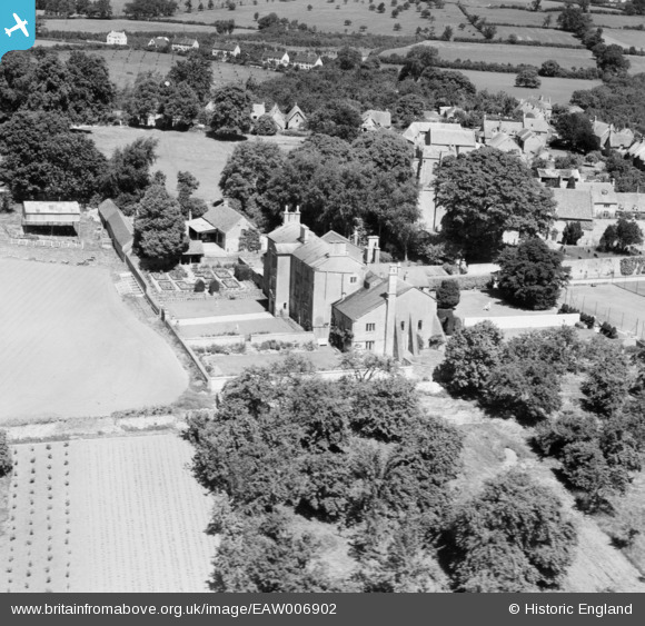
EAW006902 ENGLAND (1947). Ebrington Manor, Ebrington, 1947
© Copyright OpenStreetMap contributors and licensed by the OpenStreetMap Foundation. 2026. Cartography is licensed as CC BY-SA.
Nearby Images (17)
EAW006902

EAW006903

EAW006907

EAW006910

EAW010018

EAW006905

EAW006908

EAW006909

EAW006906

EAW006904

EAW010017

EAW010022

EAW010016

EAW010021

EAW010020

EAW010019

EAW010015

Details
| Title | [EAW006902] Ebrington Manor, Ebrington, 1947 |
| Reference | EAW006902 |
| Date | 10-June-1947 |
| Link | |
| Place name | EBRINGTON |
| Parish | EBRINGTON |
| District | |
| Country | ENGLAND |
| Easting / Northing | 418346, 239921 |
| Longitude / Latitude | -1.7323968708225, 52.056948746897 |
| National Grid Reference | SP183399 |
Pins
Be the first to add a comment to this image!