
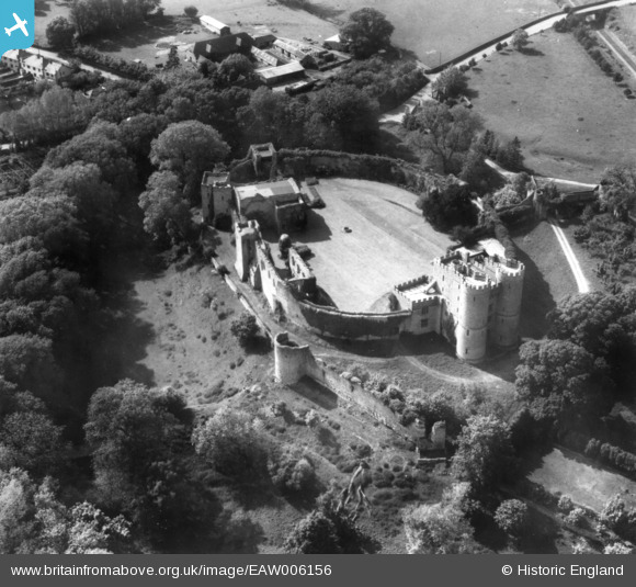
EAW006156 ENGLAND (1947). Saltwood Castle, Saltwood, 1947. This image has been produced from a print.
© Copyright OpenStreetMap contributors and licensed by the OpenStreetMap Foundation. 2026. Cartography is licensed as CC BY-SA.
Nearby Images (13)
EAW006156

EAW004694

EAW006155

EAW004693

EAW006154

EAW006152

EAW006153

EAW004690

EAW004689

EAW004692

EAW004691

EAW002869

EAW002870

Details
| Title | [EAW006156] Saltwood Castle, Saltwood, 1947. This image has been produced from a print. |
| Reference | EAW006156 |
| Date | 27-May-1947 |
| Link | |
| Place name | SALTWOOD |
| Parish | SALTWOOD |
| District | |
| Country | ENGLAND |
| Easting / Northing | 616147, 135888 |
| Longitude / Latitude | 1.0863363432666, 51.080998340387 |
| National Grid Reference | TR161359 |
Pins
Be the first to add a comment to this image!