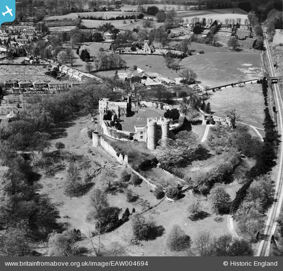
EAW004694 ENGLAND (1947). Saltwood Castle, Saltwood, 1947

© Copyright OpenStreetMap contributors and licensed by the OpenStreetMap Foundation. 2026. Cartography is licensed as CC BY-SA.

Nearby Images (13)

EAW004694
  0° 0m
EAW006156
  230° 26m
EAW006155
  301° 32m
EAW006152
  318° 37m
EAW006154
  302° 39m
EAW006153
  307° 52m
EAW004690
  8° 58m
EAW004693
  252° 58m
EAW004689
  116° 68m
EAW004691
  354° 83m
EAW002869
  23° 94m
EAW004692
  279° 106m
EAW002870
  348° 107m

Details

Title [EAW004694] Saltwood Castle, Saltwood, 1947
Reference EAW004694
Date 26-April-1947
Link
Place name SALTWOOD
Parish SALTWOOD
District
Country ENGLAND
Easting / Northing 616167, 135905
Longitude / Latitude 1.0866316454733, 51.081143467134
National Grid Reference TR162359

Pins


totoro
Sunday 27th of October 2013 09:33:31 PM
Saltwood Castle Grade 1 listed building English Heritage Building ID: 175639. Post code CT21 4QU. In private ownership, no general public access. The present castle stands on the site of earlier castles, the first one being reported to have been constructed in 488 Castle. Largely ruinous. Core of inner curtain wall C12 (or possibly C11). Rest C12, C13 and C14. Late C14 work by Archbishop Courtenay. Archbishop Lanfranc took Saltwood into his personal possession in 1086; it apparently remained the property of the archbishops for much of the Middle Ages. Murder of Thomas a Becket said to have been planned here (1170)- at the time the Castle was in the hands of Runulf de Broc and Thomas was seeking the return of the Castle to the Church. The square towers of the inner ward probably date from around 1160 and the round towers of the outer ward or barbican are 14th century. The arms of Archbishop Courtney distinguish the great gatehouse built when he made the castle his chief residence from 1382. 1385 extension to gatehouse Probably ruined by earthquake in 1580. Restoration and additions of 1880s by F. Beeston, and by Philip Tilden in 1930s. Somewhat protected in WW2 as Hermann Goering wished to use the castle post-invasion.

totoro
Sunday 27th of October 2013 09:31:52 PM

totoro
Sunday 27th of October 2013 09:26:11 PM
St Peter and Saint Paul, Grade 2* listed building, English Heritage Building ID: 175645 Parish church. Late C11 or C12, C13, C14, restored late C19. Chancel: C14; West Tower: C13, Nave: Late C11 or C12.

totoro
Sunday 27th of October 2013 09:25:13 PM
Railway line. Formerly a branch line with Sanderling to the top of the image and Sandgate to the bottom. At Sanderling the line joins the Ashford-Folkestone line which remains in use. In 1931 the track here was made single track and to the bottom of the image was curtailed to Hythe. This railway line was closed in 1951.

totoro
Sunday 27th of October 2013 09:22:56 PM
For 'Sanderling' read 'Sandling'

ChrisH
Friday 20th of December 2013 04:35:43 PM