
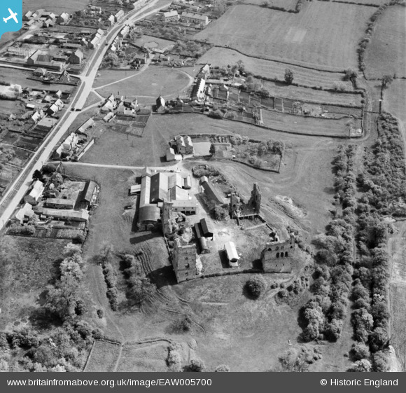
EAW005700 ENGLAND (1947). Sheriff Hutton Castle and Castle Farm, Sheriff Hutton, 1947
© Copyright OpenStreetMap contributors and licensed by the OpenStreetMap Foundation. 2026. Cartography is licensed as CC BY-SA.
Nearby Images (5)
EAW005700

EAW005699
, Sheriff Hutton, 1947. This image has been produced from a print.")
EAW005698

EAW005697

EAW005696

Details
| Title | [EAW005700] Sheriff Hutton Castle and Castle Farm, Sheriff Hutton, 1947 |
| Reference | EAW005700 |
| Date | 15-May-1947 |
| Link | |
| Place name | SHERIFF HUTTON |
| Parish | SHERIFF HUTTON |
| District | |
| Country | ENGLAND |
| Easting / Northing | 465236, 466248 |
| Longitude / Latitude | -1.002571020544, 54.087822539867 |
| National Grid Reference | SE652662 |
Pins
Be the first to add a comment to this image!