
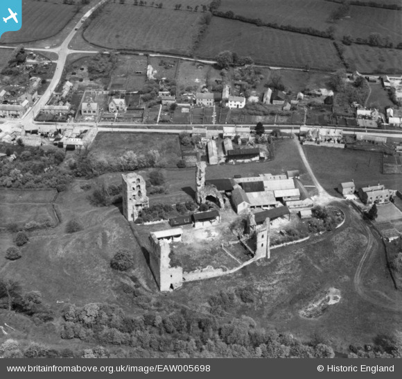
EAW005698 ENGLAND (1947). Sheriff Hutton Castle and Castle Farm, Sheriff Hutton, 1947. This image has been produced from a print.
© Copyright OpenStreetMap contributors and licensed by the OpenStreetMap Foundation. 2026. Cartography is licensed as CC BY-SA.
Nearby Images (5)
EAW005698

EAW005697

EAW005700

EAW005699
, Sheriff Hutton, 1947. This image has been produced from a print.")
EAW005696

Details
| Title | [EAW005698] Sheriff Hutton Castle and Castle Farm, Sheriff Hutton, 1947. This image has been produced from a print. |
| Reference | EAW005698 |
| Date | 15-May-1947 |
| Link | |
| Place name | SHERIFF HUTTON |
| Parish | SHERIFF HUTTON |
| District | |
| Country | ENGLAND |
| Easting / Northing | 465192, 466259 |
| Longitude / Latitude | -1.0032412786431, 54.087926973358 |
| National Grid Reference | SE652663 |
Pins

Sparky |
Friday 29th of September 2017 11:15:18 PM |