
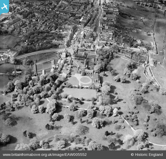
EAW005552 ENGLAND (1947). Auckland Castle and environs, Bishop Auckland, 1947
© Copyright OpenStreetMap contributors and licensed by the OpenStreetMap Foundation. 2026. Cartography is licensed as CC BY-SA.
Nearby Images (4)
EAW005552

EAW005553

EAW005549

EAW005548

Details
| Title | [EAW005552] Auckland Castle and environs, Bishop Auckland, 1947 |
| Reference | EAW005552 |
| Date | 17-May-1947 |
| Link | |
| Place name | BISHOP AUCKLAND |
| Parish | BISHOP AUCKLAND |
| District | |
| Country | ENGLAND |
| Easting / Northing | 421376, 530212 |
| Longitude / Latitude | -1.6685469440762, 54.666420695351 |
| National Grid Reference | NZ214302 |
Pins

Chells809 |
Thursday 2nd of January 2014 09:10:40 PM | |
|
Chells809 |
Tuesday 15th of October 2013 11:31:48 PM | |
|
Chells809 |
Tuesday 24th of September 2013 10:11:55 PM | |

John Swain |
Saturday 17th of August 2013 09:56:45 AM | |
|
John Swain |
Saturday 17th of August 2013 09:55:06 AM | |
|
John Swain |
Friday 16th of August 2013 07:20:14 PM | |
|
John Swain |
Wednesday 7th of August 2013 09:57:15 AM | |
|
John Swain |
Wednesday 7th of August 2013 09:50:53 AM | |
|
John Swain |
Wednesday 7th of August 2013 09:49:41 AM | |
|
John Swain |
Wednesday 7th of August 2013 09:48:43 AM | |
|
John Swain |
Wednesday 7th of August 2013 09:47:23 AM | |
|
John Swain |
Wednesday 7th of August 2013 09:45:18 AM | |
|
John Swain |
Wednesday 7th of August 2013 09:43:09 AM | |
|
John Swain |
Wednesday 7th of August 2013 09:42:22 AM | |
|
John Swain |
Wednesday 7th of August 2013 09:41:42 AM | |
|
John Swain |
Wednesday 7th of August 2013 09:40:29 AM | |
|
John Swain |
Wednesday 7th of August 2013 09:37:13 AM | |

Class31 |
Thursday 27th of June 2013 09:37:32 PM | |
|
Class31 |
Thursday 27th of June 2013 09:34:07 PM | |
The popular market has been held in the two acre Market Place for centuries and was in full swing when this image was taken on a fine, sunny morning on Saturday, May 17, 1947. Markets were also held on Thursdays. |
John Swain |
Wednesday 7th of August 2013 09:33:35 AM |
|
Class31 |
Thursday 27th of June 2013 09:23:19 PM |
User Comment Contributions

A view looking west, from Castle Square, along the south side of the Market Place, with some fine examples of 18th and 19th century buildings. |
John Swain |
Friday 16th of August 2013 07:29:34 PM |
A well-used image of the northern end of Bishop Auckland in the immediate postwar period, looking in a westerly direction, on a fine late morning in the middle of May, with the popular Saturday market well under way in the spacious Market Place. |
John Swain |
Wednesday 7th of August 2013 10:21:53 AM |
This image was used as a postcard during the 1950s and has featured in some of the local history texts on the area, such as the one written and published by Barbara Laurie, "The Changing Face of Bishop Auckland". If one consults Tom Hutchinson's "Bishop Auckland: A Century of Postcards", it becomes apparent that the northern end of the town has attracted the attention of photographers for many decades, covering the Castle and Park, Market Place, Newgate Street, Bondgate, the rivers Wear and Gaunless, and many other famous locations. |
John Swain |
Wednesday 7th of August 2013 10:16:09 AM |
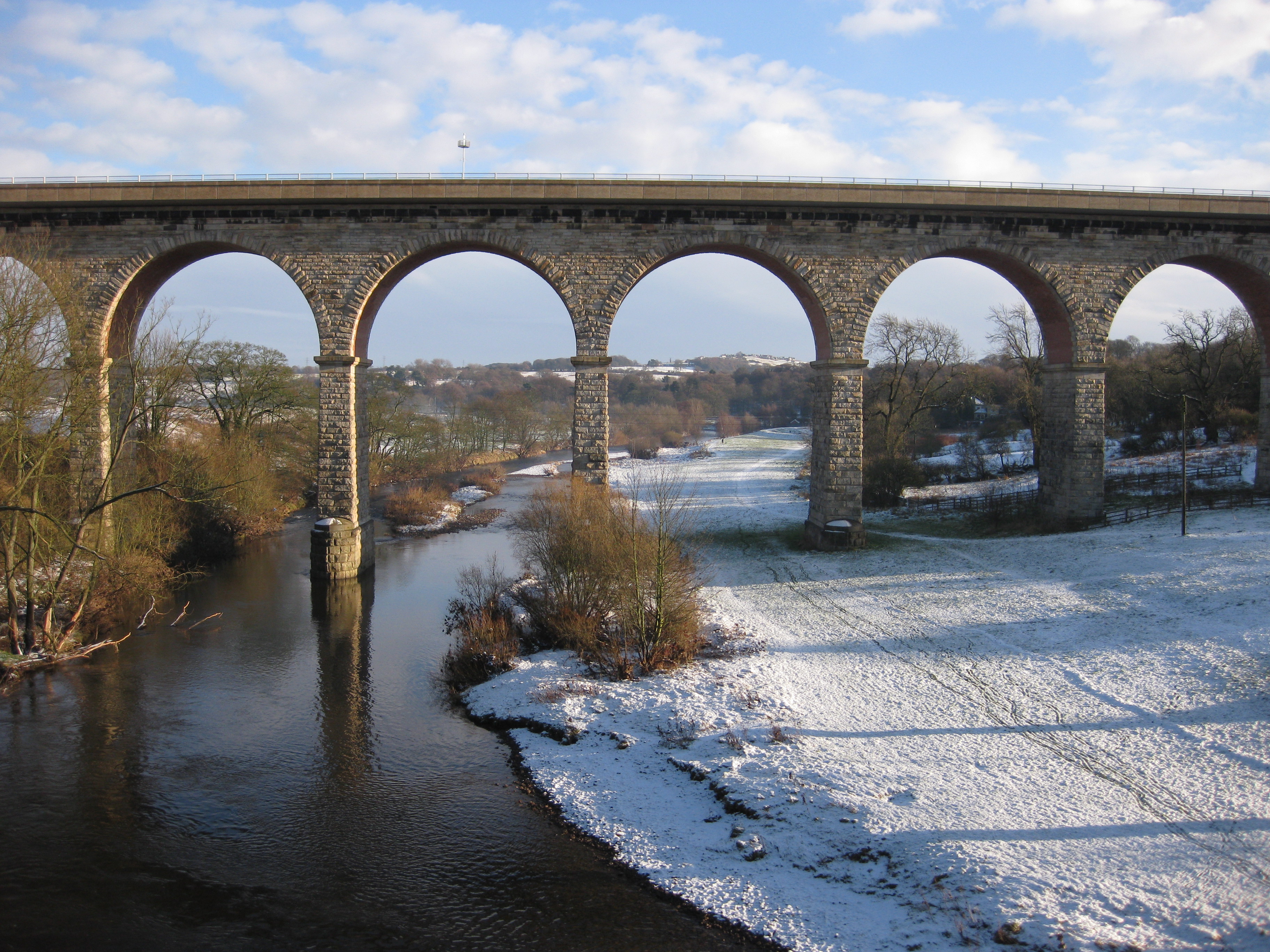
The image referred to is that by Aerofilms EAW005552, as shown in the main picture, and not the one of Newton Cap Viaduct taken by this correspondent last winter, looking east from the Bishop Skirlaw Bridge towards the Magnesian Limestone escarpment at Westerton. |
John Swain |
Wednesday 7th of August 2013 10:16:09 AM |